THREAT OF FLASH FLOODS.An upper-level low along withthe remnants of Henri willmove northeast through NewEnangld today and toghnit.High pressure aloft will buildoverhead for Tuesday throughThursday while surface highbuilds over the westernAtlantic into the southeasternCONUS.
A cold front willapproach Friday and it willstall out nearby for theweekend.
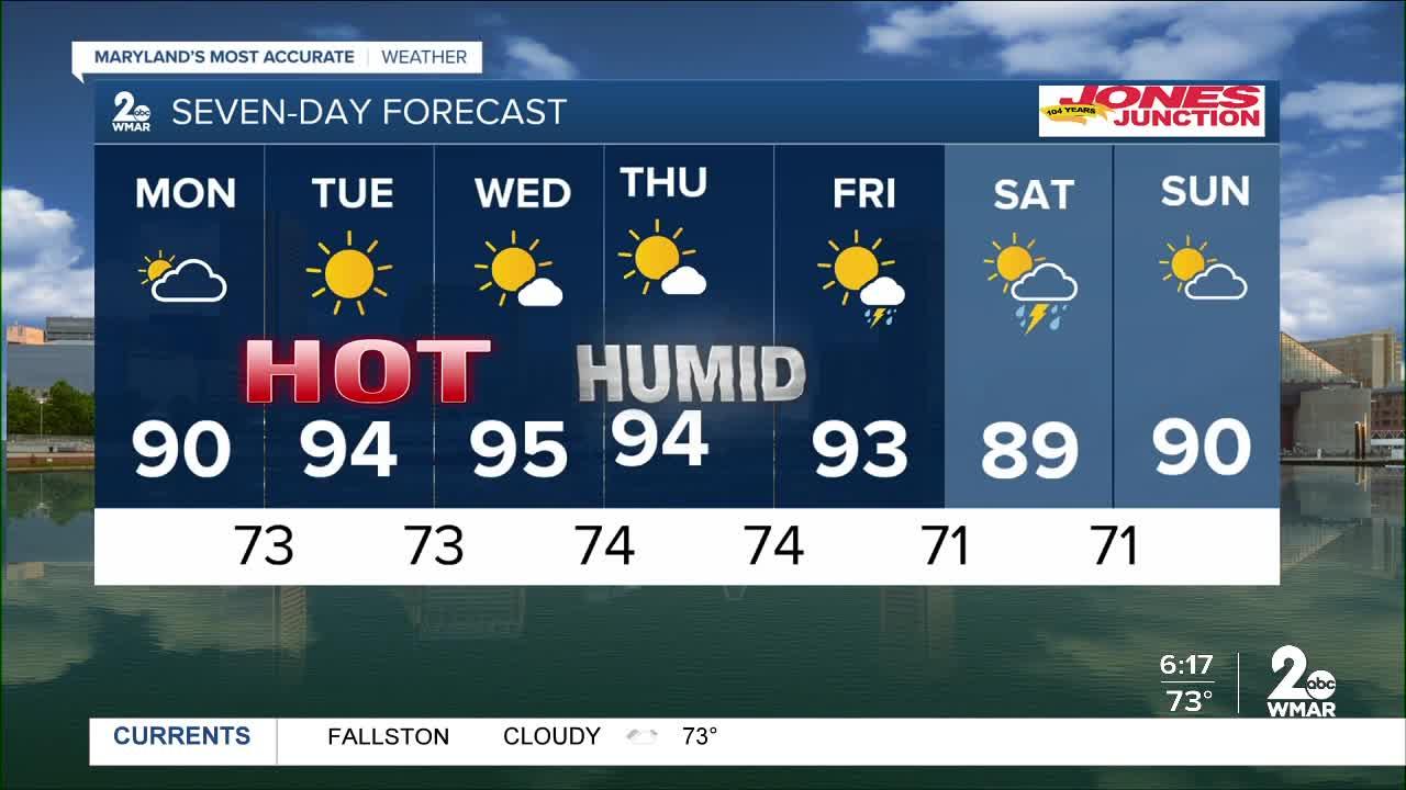
Monday A slightchance of showers before 8am,then a slight chance ofshowers and thunderstormsafter 2pm.
Mostly cloudy, thengradually becoming sunny, witha high near 91.
West wind 5 to9 mph.
Chance of precipitationis 20%.
Monday NightMostlyclear, with a low around 72.Southwest wind around 5 mphbecoming calm in the evening.TuesdaySunny, with a high near94.
Northwest wind 3 to 6 mph.Tuesday NightMostly clear,with a low around 72.
Lhtigand variable wind.WednesdaySunny, with a highnear 94.
Wednesday NigMohtlyclear, with a low around 74.ThursdaySunny, with a ghhinear 94.
Thursday NightPartlycloudy, with a low around 74.FridayScattered showers aerft2pm.
Mostly sunny, with a highnear 93.
Chance ofprecipitation is 30%.
FridayNightScattered showers.
Partlycloudy, with a low around 73.Chance of precipitatioisn30%.
SaturdayScatteredshowers.
Mostly sunny, with ahigh nea90r .
Chance ofprecipitation is 30%.
SaturdayNightScattered showers.
Parytlcloudy, with a low around 71.Chance of precipitation is30%.
SundayScattered showers.Mostly sunny, with a high near89.
Chance of precipitatioisn30%.DISABLED VEHICLE SB 89